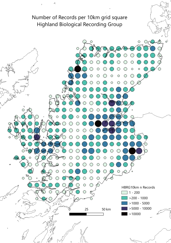
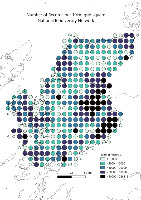
The number of records in both the HBRG database and NBN database reveals that many parts of Highland remain under-recorded. The maps on this page show the number of records in each 10km square of the National Grid in Highland. The data are as of 28 February 2026.
Note the different intervals on the two maps – the NBN map has 6.6 million records in total, the HBRG map a quarter of a million in total.
The upland elevation areas of Highland have fewer records than areas at lower elevation; hectads in Speyside have the highest number of records. Humboldt’s enigma is the observation that although mountain areas occupy a smaller area of land than lower elevations, mountains typically contain higher species diversity. Given this, and the relatively low number of records in higher elevations, more recording effort in these areas of fewer records shown on these maps would be informative and interesting, and may increase the number of species recorded in Highland.
National Biodiversity Network – number of records / hectad
Highland Biological Recording Group – number of records / hectad